


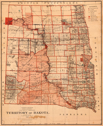
1882 Dakota
Territory of Dakota, Department of the Interior, General Land Office, N.C. McFarland, Commissioner, 1882, C. Roeser, Principal Draughtsman, GLO, (New York, NY: Julius Bien & Co., 1882) Scale: 18 miles = 1 inch SAHRL 978.4/No. 4
The forty mile corridor adjacent to the Northern Pacific Railroad line is clearly delineated on this map geared for seekers of lands available in Dakota. The remaining sections within the 40 mile corridor were available for homesteading.