We’ve launched a new web portal! Visit findhistory.nd.gov to search our collections.
Due to a road closure, the Killdeer Mountain Battlefield State Historic Site
is temporarily closed.

Subscribe to SHSND podcasts
Located about 20 miles north of Mandan, ND.
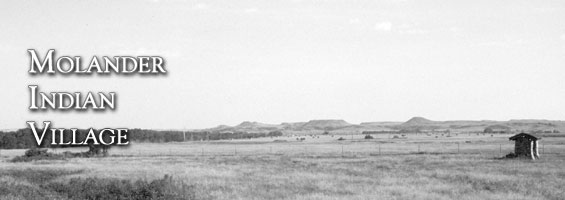
A kiosk at the entrance to the village and fieldstone markers.
No Rental Facilities
Free admission, donations welcome.
No Related Links
Molander Indian Village State Historic Site is a Hidatsa earthlodge village, located about twenty miles north of Mandan, in Oliver County, on the east side of Highway 1806. According to Lewis and Clark, the Awaxawi Hidatsa Indians lived in this village overlooking the Missouri River around 1764. Their neighbors, the Mandans, lived in similar villages centered around the mouth of the Heart River. The Awaxawi people are one of three groups of Hidatsas. Awaxawi (pronounced Ah-WAH-ha-WEE) means “Village on the Hill.”
Hidatsa Indians traditionally settled on the west side of the Missouri River in a region north of the Mandans. Hidatsa territory stretched from the hills called Square Buttes, south of the town of Price, Oliver County, to the mouth of the Yellowstone River. Molander Village is near the southern extent of this territory. The Awaxawi moved to this area from the east, arriving at Molander Village in the 1700s. They lived there until the 1781-1782 smallpox epidemic killed approximately one-half of their people. The survivors moved north to Amahami Village at the mouth of the Knife River. Today, a remnant of Amahami Village lies beside the Mercer County Courthouse in Stanton.
Faint depressions at Molander Village mark the locations of nearly forty houses, which were protected by a dry moat or fortification ditch. A wooden palisade stood on the inside edge of the ditch. There were six projections, called bastions, along the ditch. The bastions gave the villagers a clear view and open line of fire down the palisade walls. Each house, or earthlodge, measured forty to sixty feet in diameter and stood ten to fifteen feet high. An extended family of up to twenty people lived in each house.
Like the Mandans and Arikaras, Hidatsa Indians were farmers who grew crops in nearby gardens on the Missouri River floodplain. In 1968 archeological test excavations at the site discovered seeds of flint corn (a hardy, early-ripening variety of maize), squash, beans, wild plum, wild grape, and wild cherry. Molander was a summer village occupied from spring through the fall. Each fall the inhabitants moved into a temporary winter village on the river bottoms where trees provided shelter and firewood.
There is a collapsed log cabin and stable near the eastern edge of the village. The buildings were reportedly built by an early settler around 1882 and are not related to the prehistoric site. The kiosk at the entrance to the village and the fieldstone markers were built by the Civilian Conservation Corps.
This site is surrounded by private land and is not accessible. For more information, contact the Historic Preservation Division, State Historical Society of North Dakota, 612 East Boulevard Ave., Bismarck, ND, 58505, or call 701.328.2666.
SHSND Address:
612 East Boulevard Ave.
Bismarck, North Dakota 58505
Get Directions
SHSND Hours:
Museum Store: 8am - 5pm M-F; Sat. & Sun. 10am - 5pm.
State Archives: 8am - 4:30pm., M-F, except state holidays, and 2nd Sat. of each month, 10am - 4:30 pm.
State Historical Society offices: 8am - 5pm M-F, except state holidays.
Contact SHSND:
phone: 701.328.2666
email: history@nd.gov