Fort Mandan State Historic Site is temporarily closed for maintenance until further notice.
Intro | Elementary | High School | Data Tables | Inspector Reports | Consolidation Maps |
Stanford Test | Architect's Plan | Photographs | Activities
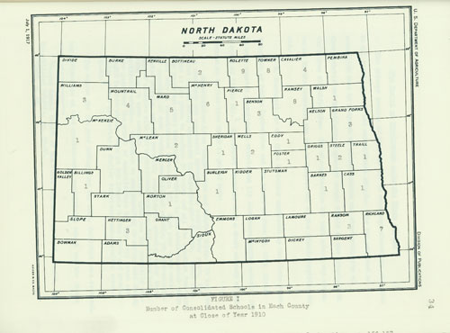
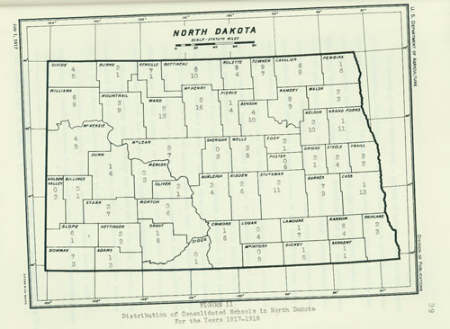
Source: Norman H. Hanson, History of Consolidated Schools in North Dakota. MS Thesis, University of North Dakota, 1946.
Address:
612 East Boulevard Ave.
Bismarck, North Dakota 58505
Get Directions
Hours:
State Museum and Store: 8 a.m. - 5 p.m. M-F; Sat. & Sun. 10 a.m. - 5 p.m.
We are closed New Year's Day, Easter, Thanksgiving Day, Christmas Eve, and Christmas Day.
State Archives: 8 a.m. - 4:30 p.m. M-F, except state holidays; 2nd Sat. of each month, 10 a.m. - 4:30 p.m. Appointments are recommended. To schedule an appointment, please contact us at 701.328.2091 or archives@nd.gov.
State Historical Society offices: 8 a.m. - 5 p.m. M-F, except state holidays.
Contact Us:
phone: 701.328.2666
email: history@nd.gov
Social Media:
See all social media accounts